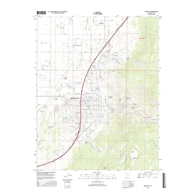
2017 Map of Cedar City
USGS Topo · Published 2017About this map
Cedar City serves as the focal point of this 2017 survey, situated at the base of the dramatic Hurricane Cliffs and The Red Hill. The map documents the city's academic and civic infrastructure, anchored by the campuses of Southern Utah Univ and George Wythe Univ, along with the Cedar City Cem and Cedar City Regional Airport. The terrain to the east rises sharply into high-elevation features like Cedar Mtn and Square Mtn, while the western landscape is defined by the Cross Hollow Hills and the winding course of Coal Cr. A notable geological transition is visible in the south, where the modern city grid meets the ancient Lava Flow near The Iron Bowl. This record captures the interaction between a growing urban center and the complex high-desert topography of Iron County, from the seasonal drainage of Squaw Cr to the high-country waters of Green Lake.
Find a feature on this map
170 named features on this map. Tap any name to fly to it.
Don’t see what you’re looking for? This feature index may not catch every label — zoom into the map to look around manually.
Map Details
Editions of this 2017 Cedar City Map
This is the sole edition of this map. No revisions or reprints were ever made.
Other maps of this area

1885 · St. George
USGS Topo · 1:250,000

1886 · Kanab
USGS Topo · 1:250,000

1891 · St. George
USGS Topo · 1:250,000

1949 · Cedar City NW
USGS Topo · 1:24,000

1950 · Cedar City NW
USGS Topo · 1:24,000

1950 · Kanarraville
USGS Topo · 1:24,000

1950 · Enoch
USGS Topo · 1:24,000

1950 · Cedar City
USGS Topo · 1:24,000

1950 · Enoch
USGS Topo · 1:62,500

1950 · Cedar City
USGS Topo · 1:62,500