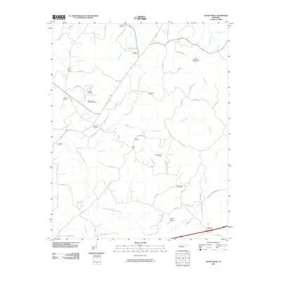
2010 Map of Cedar Grove
USGS Topo · Published 2010About this map
Middle Fork Forked Deer River and Griffin Creek define the drainage of this rural Tennessee landscape, where small family settlements and historic burying grounds are scattered across the terrain. The Cedar Grove Post Office serves as a central point of community identity, while the surrounding hills are marked by numerous cemeteries such as Furgerson Cemetery, Woodard Cemetery, and Providence Cemetery. These sites, along with the Mount Gilead Lookout Tower to the south, provide clear evidence of long-standing family ties and land management in Carroll County.
Find a feature on this map
65 named features on this map. Tap any name to fly to it.
Don’t see what you’re looking for? This feature index may not catch every label — zoom into the map to look around manually.
Map Details
Editions of this 2010 Cedar Grove Map
This is the sole edition of this map. No revisions or reprints were ever made.
Other maps of this area

1936 · Clarksburg
USGS Topo · 1:24,000

1936 · Lexington
USGS Topo · 1:24,000

1936 · Center Ridge
USGS Topo · 1:24,000

1950 · Palmer Shelter
USGS Topo · 1:24,000

1950 · Lexington
USGS Topo · 1:24,000

1950 · Clarksburg
USGS Topo · 1:24,000

1953 · Claybrook
USGS Topo · 1:24,000

1955 · Juno
USGS Topo · 1:24,000

1956 · Blytheville
USGS Topo · 1:250,000

1959 · Blytheville
USGS Topo · 1:250,000