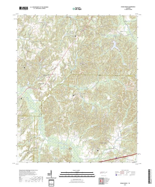
2022 Map of Cedar Grove
USGS Topo · Published 2022About this map
Cedar Grove serves as a central point in this West Tennessee landscape where the borders of Carroll, Madison, and Henderson Counties converge. The terrain is defined by the winding course of the Middle Fork Forked Deer River, which creates a broad wetland corridor in the southern half of the quadrangle. Small settlements like Hickory Flat, Mount Gilead, and Law are scattered throughout, connected by a network of rural routes including the Broadway of America. This survey is particularly rich for genealogical research, documenting numerous family-named landmarks such as Furgerson Cem, Woodard Cem, and Spain Cem. The drainage patterns of Grassy Hollow Cr and Griffin Cr illustrate the dissected topography of the region, while man-made features like Hoopers Lake and OFDBA 87-3 Lake show local water management and recreation sites.
Find a feature on this map
91 named features on this map. Tap any name to fly to it.
Don’t see what you’re looking for? This feature index may not catch every label — zoom into the map to look around manually.
Map Details
Editions of this 2022 Cedar Grove Map
This is the sole edition of this map. No revisions or reprints were ever made.
Other maps of this area

1936 · Clarksburg
USGS Topo · 1:24,000

1936 · Lexington
USGS Topo · 1:24,000

1936 · Center Ridge
USGS Topo · 1:24,000

1950 · Palmer Shelter
USGS Topo · 1:24,000

1950 · Lexington
USGS Topo · 1:24,000

1950 · Clarksburg
USGS Topo · 1:24,000

1953 · Claybrook
USGS Topo · 1:24,000

1955 · Juno
USGS Topo · 1:24,000

1956 · Blytheville
USGS Topo · 1:250,000

1959 · Blytheville
USGS Topo · 1:250,000