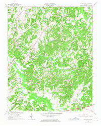
1966 Map of Cedar Grove
USGS Topo · Published 1968About this map
The Middle Fork Forked Deer River and its numerous tributaries, including Grassy Hollow Creek and Mill Creek, define the landscape of west Tennessee in the mid-1960s. This survey focuses on the rural communities of Cedar Grove and Hickory Flat, revealing a pattern of development closely tied to church congregations and family burial grounds. Notable landmarks include the Mt Gilead Lookout Tower and a Radio Tower, which stand as prominent points above the creek bottoms.
Find a feature on this map
38 named features on this map. Tap any name to fly to it.
Don’t see what you’re looking for? This feature index may not catch every label — zoom into the map to look around manually.
Map Details
Editions of this 1966 Cedar Grove Map
This is the sole edition of this map. No revisions or reprints were ever made.
Other maps of this area

1936 · Clarksburg
USGS Topo · 1:24,000

1936 · Lexington
USGS Topo · 1:24,000

1936 · Center Ridge
USGS Topo · 1:24,000

1950 · Palmer Shelter
USGS Topo · 1:24,000

1950 · Lexington
USGS Topo · 1:24,000

1950 · Clarksburg
USGS Topo · 1:24,000

1953 · Claybrook
USGS Topo · 1:24,000

1955 · Juno
USGS Topo · 1:24,000

1956 · Blytheville
USGS Topo · 1:250,000

1959 · Blytheville
USGS Topo · 1:250,000