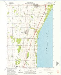
1974 Map of Cedar Grove
USGS Topo · Published 1977About this map
Lake Michigan defines the eastern edge of this mid-1970s survey, where the shoreline meets a landscape of precise agricultural plots and growing coastal communities. The village of Cedar Grove sits as a central hub, flanked by Oostburg to the north and the town of Belgium at the southern boundary. This era shows the established footprint of the Chicago and North Western railroad, which parallels the coast and links the various dairy-country settlements.
Find a feature on this map
32 named features on this map. Tap any name to fly to it.
Don’t see what you’re looking for? This feature index may not catch every label — zoom into the map to look around manually.
Map Details
Editions of this 1974 Cedar Grove Map
This is the sole edition of this map. No revisions or reprints were ever made.
Other maps of this area

1892 · Port Washington
USGS Topo · 1:62,500

1904 · Port Washington
USGS Topo · 1:62,500

1954 · Sheboygan Falls
USGS Topo · 1:62,500

1954 · Sheboygan South
USGS Topo · 1:62,500

1954 · Sheboygan Falls
USGS Topo · 1:24,000

1954 · Sheboygan South
USGS Topo · 1:24,000

1954 · Milwaukee
USGS Topo · 1:250,000

1958 · Milwaukee
USGS Topo · 1:250,000
1958 · Port Washington East
USGS Topo · 1:24,000

1959 · Port Washington West
USGS Topo · 1:24,000