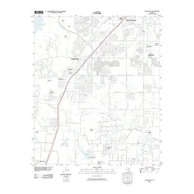
2010 Map of Cedar Hill
USGS Topo · Published 2010About this map
Joe Pool Lake dominates the northwest corner of this landscape where the suburban expansion of the Dallas-Fort Worth metroplex meets the limestone escarpment. The city of Cedar Hill serves as a central hub, flanked by the growing communities of Duncanville and DeSoto. This era shows a transition from rural ranching to residential development, though significant open spaces remain at the Mount Lebanon Encampment and Cedar Hill Bible Camp.
Find a feature on this map
76 named features on this map. Tap any name to fly to it.
Don’t see what you’re looking for? This feature index may not catch every label — zoom into the map to look around manually.
Map Details
Editions of this 2010 Cedar Hill Map
This is the sole edition of this map. No revisions or reprints were ever made.
Other maps of this area

1891 · Dallas
USGS Topo · 1:125,000

1891 · Cleburne
USGS Topo · 1:125,000

1893 · Dallas
USGS Topo · 1:125,000

1894 · Cleburne
USGS Topo · 1:125,000

1894 · Fort Worth
USGS Topo · 1:125,000

1954 · Dallas
USGS Topo · 1:250,000

1958 · Dallas
USGS Topo · 1:250,000
1958 · Oak Cliff
USGS Topo · 1:24,000
1959 · Arlington
USGS Topo · 1:24,000
1959 · Lancaster
USGS Topo · 1:24,000