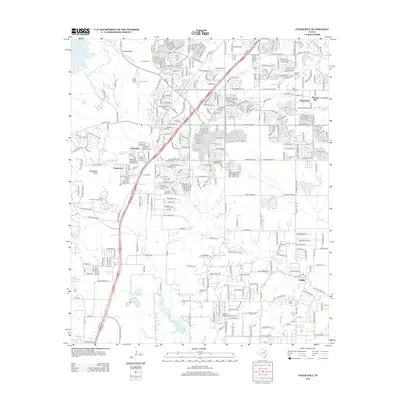
2012 Map of Cedar Hill
USGS Topo · Published 2012About this map
Joe Pool Lake dominates the northwestern corner of this landscape, its waters reaching toward the community of Cedar Bluff and the wooded terrain surrounding Inspiration Point. This 2012 survey illustrates the suburban expansion around the long-established settlements of Ovilla and Cedarview, where modern residential subdivisions and a dense road network contrast with older land markers. Traces of early regional history are preserved at Shiloh Cem and Rhodes Cem, while larger institutional footprints like Northwood Univ, Mount Lebanon Encampment, and Cedar Hill Bible Camp reflect the area's development as a center for education and gathering. A complex web of waterways, including Tenmile Cr and Red Oak Cr, meanders through the terrain, defining the natural boundaries between neighborhoods like Shamrock and Pleasant Run.
Find a feature on this map
354 named features on this map. Tap any name to fly to it.
Don’t see what you’re looking for? This feature index may not catch every label — zoom into the map to look around manually.
Map Details
Editions of this 2012 Cedar Hill Map
This is the sole edition of this map. No revisions or reprints were ever made.
Other maps of this area

1891 · Dallas
USGS Topo · 1:125,000

1891 · Cleburne
USGS Topo · 1:125,000

1893 · Dallas
USGS Topo · 1:125,000

1894 · Cleburne
USGS Topo · 1:125,000

1894 · Fort Worth
USGS Topo · 1:125,000

1954 · Dallas
USGS Topo · 1:250,000

1958 · Dallas
USGS Topo · 1:250,000

1958 · Oak Cliff
USGS Topo · 1:24,000

1959 · Arlington
USGS Topo · 1:24,000

1959 · Lancaster
USGS Topo · 1:24,000