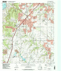
1995 Map of Cedar Hill
USGS Topo · Published 2001About this map
The rolling landscape of southern Dallas County and northern Ellis County is defined here by the rapid suburban expansion of the 1990s. While established municipal centers like Duncanville and Cedar Hill expand toward their corporate boundaries, the map preserves older rural markers and spiritual sites. Religious and social history is grounded in the Shiloh Cumberland Church and the adjacent Shiloh Cemetery, located near the southeastern corner where Red Oak Creek meanders.
Find a feature on this map
52 named features on this map. Tap any name to fly to it.
Don’t see what you’re looking for? This feature index may not catch every label — zoom into the map to look around manually.
Map Details
Editions of this 1995 Cedar Hill Map
This is the sole edition of this map. No revisions or reprints were ever made.
Other maps of this area

1891 · Dallas
USGS Topo · 1:125,000

1891 · Cleburne
USGS Topo · 1:125,000

1893 · Dallas
USGS Topo · 1:125,000

1894 · Cleburne
USGS Topo · 1:125,000

1894 · Fort Worth
USGS Topo · 1:125,000

1954 · Dallas
USGS Topo · 1:250,000

1958 · Dallas
USGS Topo · 1:250,000

1958 · Oak Cliff
USGS Topo · 1:24,000

1959 · Arlington
USGS Topo · 1:24,000

1959 · Lancaster
USGS Topo · 1:24,000