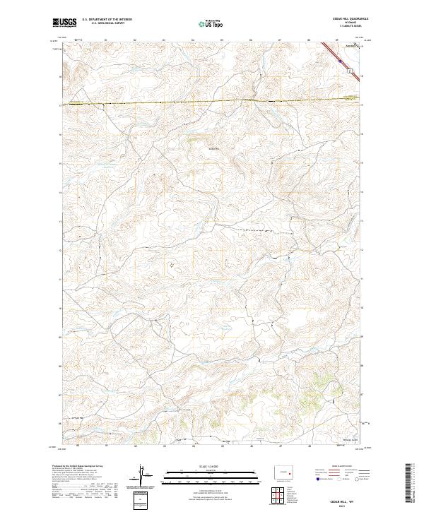
2021 Map of Cedar Hill
USGS Topo · Published 2021About this map
Cedar Hill stands as the central topographic feature in this high-plains landscape along the border of Platte and Converse counties. The area is defined by a dense network of drainage systems, with North Elkhorn Creek and its tributaries, such as Coffee Cr and Bullard Cr, carving through the terrain. Human modification of the arid environment is evident in the water management infrastructure, including Spring Cr Number 1 Reservoir and Moran Reservoir, which serve the ranching interests of the region. Local travel is facilitated by corridors like N Elkhorn Creek Rd and Ridge Rd, while the southern reaches descend toward Whiskey Gulch. The map captures a section of the American West where natural springs like Bog Hole Springs remain critical landmarks for navigation and land use.
Find a feature on this map
24 named features on this map. Tap any name to fly to it.
Don’t see what you’re looking for? This feature index may not catch every label — zoom into the map to look around manually.
Map Details
Editions of this 2021 Cedar Hill Map
This is the sole edition of this map. No revisions or reprints were ever made.
Other maps of this area

1943 · Esterbrook
USGS Topo · 1:62,500

1945 · Esterbrook
USGS Topo · 1:62,500

1949 · Shawnee
USGS Topo · 1:24,000

1949 · Irvine
USGS Topo · 1:24,000

1949 · Cedar Hill
USGS Topo · 1:24,000

1949 · Spring Creek
USGS Topo · 1:24,000

1949 · Dilts Ranch
USGS Topo · 1:24,000

1949 · Orin
USGS Topo · 1:24,000

1950 · Glendo
USGS Topo · 1:24,000

1950 · Spring Creek
USGS Topo · 1:24,000