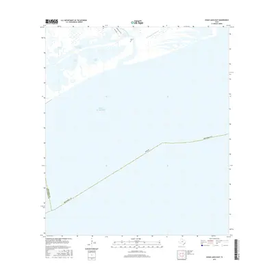
2016 Map of Cedar Lakes East
USGS Topo · Published 2016About this map
Ducroz Cem stands near the banks of the San Bernard River, a key landmark for genealogists and local historians tracking coastal settlement patterns in Brazoria County. The landscape is dominated by the intricate salt marsh and lagoon systems of Cedar Lakes and Cowtrap Lakes, which are bisected by the modern Intracoastal Waterway. This 2016 survey illustrates the navigational transition of the region, showing the path of the Old Intracoastal Waterway as it meanders through the wetlands north of the Gulf of Mexico. The area is largely defined by its maritime geography, with FM 2918 Rd providing the primary overland access toward the river's mouth. The boundary between Brazoria and Matagorda counties is traced through the coastal waters, marking the southwestern edge of this littoral survey.
Find a feature on this map
11 named features on this map. Tap any name to fly to it.
Don’t see what you’re looking for? This feature index may not catch every label — zoom into the map to look around manually.
Map Details
Editions of this 2016 Cedar Lakes East Map
This is the sole edition of this map. No revisions or reprints were ever made.
Other maps of this area

1943 · Jones Creek
USGS Topo · 1:31,680

1943 · Freeport
USGS Topo · 1:31,680

1943 · Cedar Lakes East
USGS Topo · 1:24,000

1951 · Bay City
USGS Topo · 1:250,000

1952 · Cedar Lane NE
USGS Topo · 1:24,000

1952 · Cedar Lakes West
USGS Topo · 1:24,000

1956 · Bay City
USGS Topo · 1:250,000

1958 · Bay City
USGS Topo · 1:250,000
1963 · Jones Creek
USGS Topo · 1:24,000
1964 · Freeport
USGS Topo · 1:24,000