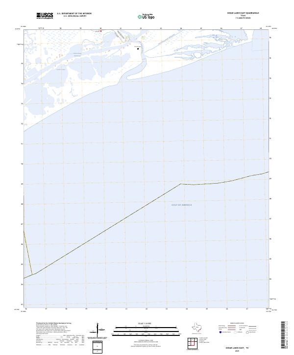
2025 Map of Cedar Lakes East
USGS Topo · Published 2025About this map
The coastal marshlands and transition zones of Brazoria County define this modern topographic survey, dominated by the intricate network of the Intracoastal Waterway and its older predecessor, the Old Intracoastal Waterway. This landscape reflects the ongoing management of Texas coastal transit, where the San Bernard River flows into the protected basins of the Cedar Lakes. The presence of the Ducroz Cem near the river bank offers a specific point of genealogical interest in an otherwise fluid environment of wetlands and tidal waters. Inland access is provided by FM 2918 and Bernard River Rd, tracing the higher ground above the expansive shoreline of the Gulf of America. The map documents the relationship between modern maritime infrastructure and the natural estuaries of the Gulf Coast.
Find a feature on this map
9 named features on this map. Tap any name to fly to it.
Don’t see what you’re looking for? This feature index may not catch every label — zoom into the map to look around manually.
Map Details
Editions of this 2025 Cedar Lakes East Map
This is the sole edition of this map. No revisions or reprints were ever made.
Other maps of this area

1943 · Jones Creek
USGS Topo · 1:31,680

1943 · Freeport
USGS Topo · 1:31,680

1943 · Cedar Lakes East
USGS Topo · 1:24,000

1951 · Bay City
USGS Topo · 1:250,000

1952 · Cedar Lane NE
USGS Topo · 1:24,000

1952 · Cedar Lakes West
USGS Topo · 1:24,000

1956 · Bay City
USGS Topo · 1:250,000

1958 · Bay City
USGS Topo · 1:250,000
1963 · Jones Creek
USGS Topo · 1:24,000
1964 · Freeport
USGS Topo · 1:24,000