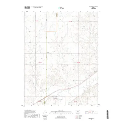
2018 Map of Cedar Point
USGS Topo · Published 2018About this map
Cedar Point sits at the southern edge of this landscape, positioned where the Cottonwood River carves its way through the hills of eastern Kansas. The settlement layout remains clearly defined by Main St, Walnut St, and 1st St, indicating a small agricultural hub established along the river's path. The surrounding terrain is heavily dissected by several waterways, including Bruno Cr, French Cr, and Silver Cr, which drain the uplands that straddle the Marion Co and Chase Co boundary.
Find a feature on this map
35 named features on this map. Tap any name to fly to it.
Don’t see what you’re looking for? This feature index may not catch every label — zoom into the map to look around manually.
Map Details
Editions of this 2018 Cedar Point Map
This is the sole edition of this map. No revisions or reprints were ever made.
Other maps of this area
1898 · Cottonwood Falls
USGS Topo · 1:125,000
1955 · Hutchinson
USGS Topo · 1:250,000
1957 · Elmdale
USGS Topo · 1:24,000
1957 · Florence
USGS Topo · 1:24,000
1957 · Wonsevu
USGS Topo · 1:24,000
1957 · Cedar Point
USGS Topo · 1:24,000
1957 · Lincolnville SW
USGS Topo · 1:24,000
1957 · Hymer
USGS Topo · 1:24,000
1959 · Hutchinson
USGS Topo · 1:250,000
1970 · Lincolnville NE
USGS Topo · 1:24,000