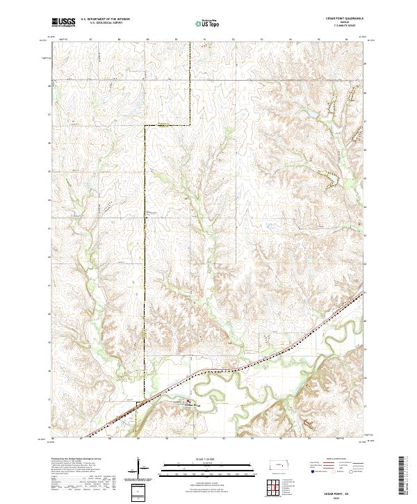
2022 Map of Cedar Point
USGS Topo · Published 2022About this map
Cedar Point sits along the southern bank of the Cottonwood River, serving as a central hub for this portion of the Flint Hills region. The landscape is defined by the winding paths of several tributaries, including French Cr and Bruno Cr, which carve through the terrain and meet the river. Higher ground to the north and west is dotted with landmarks like Robinson Spring and the Montgomery Cem, which provide specific points of interest for those tracing family roots or local land use patterns.
Find a feature on this map
36 named features on this map. Tap any name to fly to it.
Don’t see what you’re looking for? This feature index may not catch every label — zoom into the map to look around manually.
Map Details
Editions of this 2022 Cedar Point Map
This is the sole edition of this map. No revisions or reprints were ever made.
Other maps of this area

1898 · Cottonwood Falls
USGS Topo · 1:125,000

1955 · Hutchinson
USGS Topo · 1:250,000

1957 · Elmdale
USGS Topo · 1:24,000

1957 · Florence
USGS Topo · 1:24,000

1957 · Wonsevu
USGS Topo · 1:24,000

1957 · Cedar Point
USGS Topo · 1:24,000

1957 · Lincolnville SW
USGS Topo · 1:24,000

1957 · Hymer
USGS Topo · 1:24,000

1959 · Hutchinson
USGS Topo · 1:250,000

1970 · Lincolnville NE
USGS Topo · 1:24,000