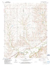
1989 Map of Cedar Point
USGS Topo · Published 1990About this map
The Cottonwood River meanders across the southern portion of this landscape, forming a fertile valley where the settlement of Cedar Point is established. This area is defined by the convergence of several major watercourses, including Doyle Creek, Cedar Creek, and Diamond Creek, which feed into the primary river system. The terrain transitions from these alluvial bottoms to the uplands of Grant township, where the drainage patterns of French Creek and Silver Creek have carved distinct draws into the limestone-capped hills.
Find a feature on this map
15 named features on this map. Tap any name to fly to it.
Don’t see what you’re looking for? This feature index may not catch every label — zoom into the map to look around manually.
Map Details
Editions of this 1989 Cedar Point Map
This is the sole edition of this map. No revisions or reprints were ever made.
Other maps of this area

1898 · Cottonwood Falls
USGS Topo · 1:125,000

1955 · Hutchinson
USGS Topo · 1:250,000

1957 · Elmdale
USGS Topo · 1:24,000

1957 · Florence
USGS Topo · 1:24,000

1957 · Wonsevu
USGS Topo · 1:24,000

1957 · Cedar Point
USGS Topo · 1:24,000

1957 · Lincolnville SW
USGS Topo · 1:24,000

1957 · Hymer
USGS Topo · 1:24,000

1959 · Hutchinson
USGS Topo · 1:250,000

1970 · Lincolnville NE
USGS Topo · 1:24,000