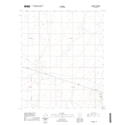
2020 Map of Cedar Point
USGS Topo · Published 2020About this map
Mescalero Ridge rises in the southeast corner of this high plains landscape, defining the local topography near the small settlement of Cedar Point. The terrain is characterized by its arid water management features, including isolated basins like Philley Tank and Little Lucky Tank. These water sources are vital landmarks in a region largely defined by its ranching and resource-management infrastructure. The area is intersected by a network of rural routes, including the Hagerman Cutoff and Aberdeen Rd, which provide connectivity across the open Chaves County landscape. The road system, including Katrina Rd and Cindy Rd, suggests a pattern of modern land division and access to remote grazing or industrial tracts typical of the New Mexico Llano Estacado.
Find a feature on this map
13 named features on this map. Tap any name to fly to it.
Don’t see what you’re looking for? This feature index may not catch every label — zoom into the map to look around manually.
Map Details
Editions of this 2020 Cedar Point Map
This is the sole edition of this map. No revisions or reprints were ever made.
Other maps of this area

1951 · King Camp
USGS Topo · 1:24,000

1952 · Connor Well
USGS Topo · 1:24,000

1953 · Basin Well
USGS Topo · 1:24,000

1954 · Carlsbad
USGS Topo · 1:250,000

1954 · Hobbs
USGS Topo · 1:250,000

1954 · Brownfield
USGS Topo · 1:250,000

1955 · Roswell
USGS Topo · 1:250,000

1958 · Carlsbad
USGS Topo · 1:250,000

1958 · Brownfield
USGS Topo · 1:250,000

1958 · Roswell
USGS Topo · 1:250,000