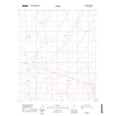
2023 Map of Cedar Point
USGS Topo · Published 2023About this map
Mescalero Ridge dominates the southeastern portion of this Chaves County landscape, rising to a local summit at Cedar Point. This arid expanse in southeastern New Mexico is defined by its water management and a grid of rural roads. Essential water sources for local ranching operations are marked by Philley Tank and Little Lucky Tank, while the transportation network consists of secondary routes such as Aberdeen Rd and the Hagerman Cutoff. The map provides a clear look at the Public Land Survey System divisions, specifically T14S and T15S across ranges R29E and R30E, illustrating how the territory is organized into sections. The presence of named tracks like Katrina Rd and Cindy Rd among the county roads indicates the modern infrastructure supporting this high-plains environment.
Find a feature on this map
14 named features on this map. Tap any name to fly to it.
Don’t see what you’re looking for? This feature index may not catch every label — zoom into the map to look around manually.
Map Details
Editions of this 2023 Cedar Point Map
This is the sole edition of this map. No revisions or reprints were ever made.
Other maps of this area

1951 · King Camp
USGS Topo · 1:24,000

1952 · Connor Well
USGS Topo · 1:24,000

1953 · Basin Well
USGS Topo · 1:24,000

1954 · Carlsbad
USGS Topo · 1:250,000

1954 · Hobbs
USGS Topo · 1:250,000

1954 · Brownfield
USGS Topo · 1:250,000

1955 · Roswell
USGS Topo · 1:250,000

1958 · Carlsbad
USGS Topo · 1:250,000

1958 · Brownfield
USGS Topo · 1:250,000

1958 · Roswell
USGS Topo · 1:250,000