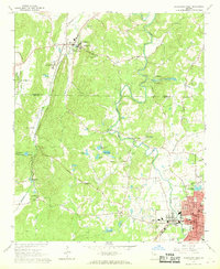
1967 Map of Cedartown West
USGS Topo · Published 1968About this map
Cave Spring anchors the northern portion of this landscape, notably serving as the site of the State School for the Deaf. The terrain transitions from the ridge-and-valley slopes of Padlock Mtn and Mt Hope toward the established grid of Cedartown in the southeast. This survey documents a rural environment deeply rooted in community institutions, evidenced by a dense network of country churches and family-named cemeteries such as Chubb Chapel, Valley Grove Ch, and Sanders Cem.
Find a feature on this map
75 named features on this map. Tap any name to fly to it.
Don’t see what you’re looking for? This feature index may not catch every label — zoom into the map to look around manually.
Map Details
Editions of this 1967 Cedartown West Map
3 editions found
Other maps of this area

1886 · Rome
USGS Topo · 1:125,000

1889 · Tallapoosa
USGS Topo · 1:125,000

1892 · Tallapoosa
USGS Topo · 1:125,000

1897 · Tallapoosa
USGS Topo · 1:125,000

1898 · Rome
USGS Topo · 1:125,000

1899 · Rome
USGS Topo · 1:125,000

1904 · Rome
USGS Topo · 1:125,000

1953 · Atlanta
USGS Topo · 1:250,000

1955 · Rome
USGS Topo · 1:250,000

1957 · Atlanta
USGS Topo · 1:250,000