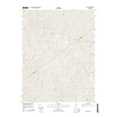
2014 Map of Cedarville
USGS Topo · Published 2014About this map
Cedarville sits at the confluence of several steep mountain runs, serving as a central point in this rural landscape during the early 21st century. The map illustrates a deeply dissected topography where settlements like Flower and Chapel are tucked into the narrow valleys of Cedar Creek and the Left Fork Steer Creek. The distribution of family and community burial grounds, such as Moss Cem, Rutherford Cem, and Moyers Cem, provides a detailed record of the long-standing family lineages in this part of West Virginia. Transportation follows the natural contours of the land, with routes like the Cedarville-Flower road connecting these small communities. The boundary between Gilmer County and Braxton County cuts diagonally through the southern half of the quadrangle, passing near Cutlips and the winding course of Steer Run.
Find a feature on this map
88 named features on this map. Tap any name to fly to it.
Don’t see what you’re looking for? This feature index may not catch every label — zoom into the map to look around manually.
Map Details
Editions of this 2014 Cedarville Map
This is the sole edition of this map. No revisions or reprints were ever made.
Other maps of this area

1893 · Sutton
USGS Topo · 1:125,000

1906 · Glenville
USGS Topo · 1:62,500

1906 · Burnsville
USGS Topo · 1:62,500

1908 · Gassaway
USGS Topo · 1:48,000

1908 · Sutton
USGS Topo · 1:48,000

1910 · Sutton Special
USGS Topo · 1:62,500

1910 · Gassaway
USGS Topo · 1:62,500

1925 · Glenville
USGS Topo · 1:62,500

1925 · Burnsville
USGS Topo · 1:62,500

1927 · Burnsville
USGS Topo · 1:62,500