2023 Map of Cedarville
USGS Topo · Published 2023About this map
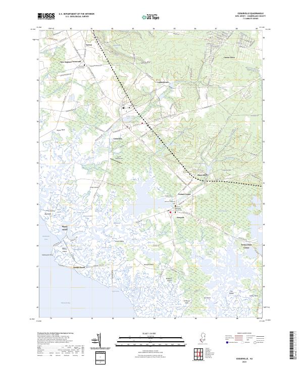
The low-lying wetlands of The Glades and Bear Swamp dominate this coastal reach of Cumberland County, where the land fragmentizes into a maze of tidal guts and points. Small upland settlements like Cedarville, Newport, and Lummistown occupy the higher ground, often centered around burial grounds such as the Old Stone Church Cem and Brick Church Cem. The interaction between the interior drainage of Cedar Creek and the Delaware Bay is visible through the intricate shoreline of Sayres Neck and Jones Island. Along the coast, established landing spots and camps like Gandys Beach and Money Island suggest a long-standing reliance on the bay's resources. Further inland, specialized landmarks like Dave's Aerodrome and the impoundment at Shaws Mill Pond indicate a landscape shaped by both local industry and modern recreation.
Find a feature on this map
147 named features on this map. Tap any name to fly to it.
Don’t see what you’re looking for? This feature index may not catch every label — zoom into the map to look around manually.
Map Details
Editions of this 2023 Cedarville Map
This is the sole edition of this map. No revisions or reprints were ever made.
Historical Maps of Turkey Point Corner Through Time
Featured Locations
- Fairfield Township, NJ
- Lawrence Township, NJ
- Downe Township, NJ
- Cedarville, Lawrence Township
- Watsons Corner, Downe Township