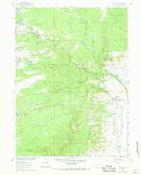
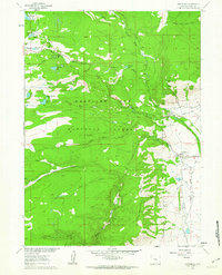
1961 Map of Centennial
USGS Topo · Published 1968About this map
High-altitude mining and recreation define this landscape in the early 1960s, where the Union Pacific rail line terminates at the settlement of Centennial. The area serves as a significant base for both industrial and academic pursuits, evidenced by the University of Wyoming Science Camp and the nearby Centennial Ranger Sta. The terrain is carved by the North Fork Little Laramie River and Libby Creek, with the prominent Centennial Ridge overlooking several lode mines.
Find a feature on this map
57 named features on this map. Tap any name to fly to it.
Don’t see what you’re looking for? This feature index may not catch every label — zoom into the map to look around manually.
Map Details
Editions of this 1961 Centennial Map
3 editions found
Other maps of this area

1906 · Medicine Bow
USGS Topo · 1:125,000

1908 · Medicine Bow
USGS Topo · 1:125,000

1954 · Rawlins
USGS Topo · 1:250,000

1958 · Rawlins
USGS Topo · 1:250,000

1961 · Sand Lake
USGS Topo · 1:24,000
1961 · Lake Owen
USGS Topo · 1:24,000
1961 · Strouss Hill
USGS Topo · 1:24,000

1961 · Medicine Bow Peak
USGS Topo · 1:24,000
1961 · Centennial
USGS Topo · 1:24,000
1961 · Morgan
USGS Topo · 1:24,000