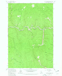
1962 Map of Center Star Mtn
USGS Topo · Published 1981About this map
South Fork Clearwater River and the Crooked River wind through this heavily forested portion of the Nezperce National Forest. The landscape is defined by its mid-20th-century extraction economy, evidenced by numerous lode mines and extensive dredge tailings lining the riverbanks. Mining claims such as the Center Star Mine, Coeur d'Alene Mine, and Lucky Strike Mine are tucked into the drainages of Center Star Mountain and Deadwood Mtn. These operations were reached via a sparse network of mountain routes, including the historic Stage Road and various jeep roads. A Gaging Station on the South Fork monitors the water flow necessary for these industrial activities. The terrain is further characterized by numerous creeks, such as Bear Creek, Newsome Creek, and Santiam Sourdough Creek, which drain the heights of Haystack Mtn and Proux Mtn.
Find a feature on this map
47 named features on this map. Tap any name to fly to it.
Don’t see what you’re looking for? This feature index may not catch every label — zoom into the map to look around manually.
Map Details
Editions of this 1962 Center Star Mtn Map
4 editions found
Other maps of this area

1931 · Buffalo Hump
USGS Topo · 1:125,000

1934 · Buffalo Hump
USGS Topo · 1:125,000

1956 · Elk City
USGS Topo · 1:250,000

1960 · Elk City
USGS Topo · 1:250,000

1962 · Golden
USGS Topo · 1:24,000

1962 · Center Star Mtn
USGS Topo · 1:24,000

1962 · Iron Mtn
USGS Topo · 1:24,000

1962 · Pilot Knob
USGS Topo · 1:24,000

1966 · Elk City
USGS Topo · 1:24,000

1966 · Lick Point
USGS Topo · 1:24,000