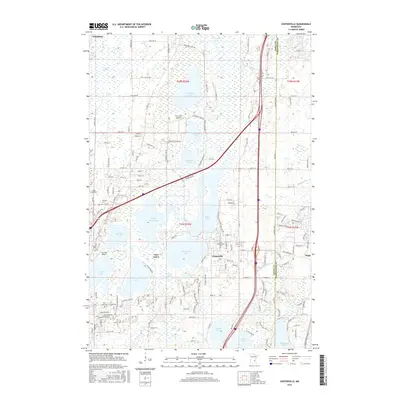
2016 Map of Centerville
USGS Topo · Published 2016About this map
Centerville and Lino Lakes occupy a landscape dominated by an intricate network of interconnected glacial basins and wetlands along the Anoka Co Washington Co line. This 2016 survey documents a region where water defines the boundaries of human settlement, with residential clusters positioned between Peltier Lake, Centerville Lake, and George Watch Lake. Local history is anchored by several burial grounds, including the centrally located Saint Genevieve Cem and the Twitchel Cem near Lino Air Park. The map also highlights the area's aviation utility, featuring Du Fresne Airport and Surfside Airport amidst the marshes. Waterways such as Rice Ck and Hardwood Cr drain the surrounding lowlands, illustrating the complex hydrology that has historically influenced the development of these Twin Cities suburbs.
Find a feature on this map
158 named features on this map. Tap any name to fly to it.
Don’t see what you’re looking for? This feature index may not catch every label — zoom into the map to look around manually.
Map Details
Editions of this 2016 Centerville Map
This is the sole edition of this map. No revisions or reprints were ever made.
Other maps of this area

1902 · White Bear
USGS Topo · 1:62,500

1948 · Stillwater
USGS Topo · 1:62,500

1949 · Stillwater
USGS Topo · 1:62,500

1951 · White Bear Lake East
USGS Topo · 1:24,000

1952 · Centerville
USGS Topo · 1:24,000

1952 · White Bear Lake West
USGS Topo · 1:24,000

1952 · New Brighton
USGS Topo · 1:24,000

1953 · Stillwater
USGS Topo · 1:250,000

1954 · Hugo
USGS Topo · 1:24,000

1955 · Circle Pines
USGS Topo · 1:24,000