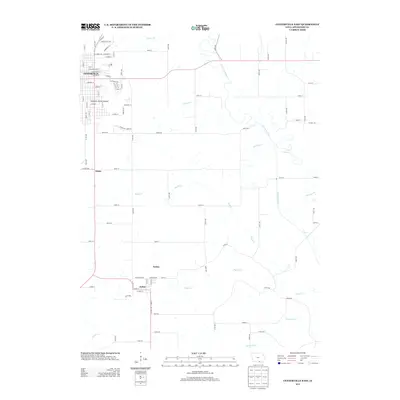
2013 Map of Centerville East
USGS Topo · Published 2013About this map
Centerville serves as the primary urban hub on this Iowa landscape, where the street grid transitions into the sprawling agricultural reaches of Appanoose County. The eastern outskirts of the city are defined by industrial corridors along Industrial Park Rd and the prominent Sixteenth Street Overpass. Moving south and east, the terrain becomes a network of creek drainages including Hickory Cr, Brush Cr, and Pigeon Cr, all flowing toward the meandering Chariton River.
Find a feature on this map
58 named features on this map. Tap any name to fly to it.
Don’t see what you’re looking for? This feature index may not catch every label — zoom into the map to look around manually.
Map Details
Editions of this 2013 Centerville East Map
This is the sole edition of this map. No revisions or reprints were ever made.
Other maps of this area

1939 · Centerville
USGS Topo · 1:62,500

1939 · Mystic
USGS Topo · 1:62,500

1941 · Centerville
USGS Topo · 1:62,500

1942 · Mystic
USGS Topo · 1:62,500

1954 · Centerville
USGS Topo · 1:250,000

1957 · Centerville
USGS Topo · 1:250,000

1958 · Centerville
USGS Topo · 1:250,000

1966 · Hiattsville
USGS Topo · 1:24,000
1966 · Mystic
USGS Topo · 1:24,000

1968 · Unionville
USGS Topo · 1:24,000