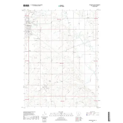
2018 Map of Centerville East
USGS Topo · Published 2018About this map
The eastern edges of Centerville give way to the dissected lowlands of the Chariton River valley in this 2018 record of Appanoose County. The landscape is defined by the winding paths of several watercourses, including Catherall Cr, Cooper Cr, and Pigeon Cr, which carve through the terrain south toward the Missouri border. Small rural settlements like Exline and Sedan anchor the southern portion of the map, while the local topography rises at Mount Ararat. The mapping of an Old Channel along the river highlights the natural shifts in the waterway over time, contrasting with the structured grid of city streets such as E Franklin St and E Jackson St in the northwest. Genealogy and local history researchers can locate several family and community burial grounds, including the Oakland Cem and Mount Ararat Cem, which serve as vital markers of the area's early settlement patterns.
Find a feature on this map
108 named features on this map. Tap any name to fly to it.
Don’t see what you’re looking for? This feature index may not catch every label — zoom into the map to look around manually.
Map Details
Editions of this 2018 Centerville East Map
This is the sole edition of this map. No revisions or reprints were ever made.
Other maps of this area

1939 · Centerville
USGS Topo · 1:62,500

1939 · Mystic
USGS Topo · 1:62,500

1941 · Centerville
USGS Topo · 1:62,500

1942 · Mystic
USGS Topo · 1:62,500

1954 · Centerville
USGS Topo · 1:250,000

1957 · Centerville
USGS Topo · 1:250,000

1958 · Centerville
USGS Topo · 1:250,000

1966 · Hiattsville
USGS Topo · 1:24,000
1966 · Mystic
USGS Topo · 1:24,000

1968 · Unionville
USGS Topo · 1:24,000