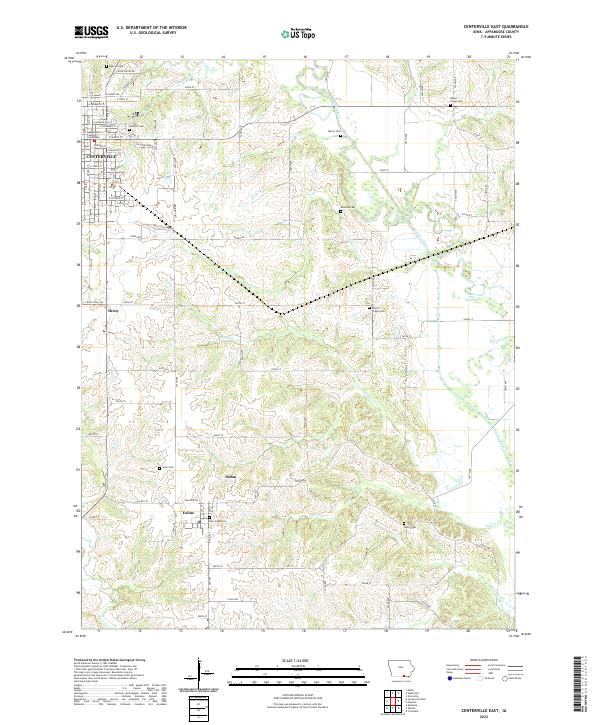
2022 Map of Centerville East
USGS Topo · Published 2022About this map
The Appanoose County Courthouse stands at the urban heart of Centerville, anchoring a landscape that quickly transitions from organized city streets to the winding drainage basins of Appanoose County. To the southeast, the small settlements of Exline and Sedan appear near the southern border, connected by rural routes like Shariton Rd. The eastern half of the map is defined by the wandering course of the Chariton River, which features an Old Channel indicating how the river's path has shifted over time. Genealogists will find a high density of burial sites across these townships, ranging from the Hebrew Cem and Oakland Cem in the north to the Salem Cem and New Hope Cem further south. The terrain is deeply etched by a network of waterways including Hickory Cr and Pigeon Cr, which carved the ridges where smaller locales like Thirty were established.
Find a feature on this map
52 named features on this map. Tap any name to fly to it.
Don’t see what you’re looking for? This feature index may not catch every label — zoom into the map to look around manually.
Map Details
Editions of this 2022 Centerville East Map
This is the sole edition of this map. No revisions or reprints were ever made.
Other maps of this area

1939 · Centerville
USGS Topo · 1:62,500

1939 · Mystic
USGS Topo · 1:62,500

1941 · Centerville
USGS Topo · 1:62,500

1942 · Mystic
USGS Topo · 1:62,500

1954 · Centerville
USGS Topo · 1:250,000

1957 · Centerville
USGS Topo · 1:250,000

1958 · Centerville
USGS Topo · 1:250,000

1966 · Hiattsville
USGS Topo · 1:24,000
1966 · Mystic
USGS Topo · 1:24,000

1968 · Unionville
USGS Topo · 1:24,000