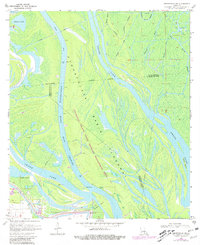
1970 Map of Centerville NW
USGS Topo · Published 1981About this map
The Attakapas Island State Wildlife Management Area occupies the heart of this riverine landscape, where the shifting waters of the Atchafalaya Basin Main Channel navigate a complex deltaic environment. Situated at the intersection of Iberia, St. Martin, and St. Mary parishes, the map illustrates the critical infrastructure of the Atchafalaya Basin Floodway, bounded by an extensive Levee system designed to manage the heavy discharge of the Atchafalaya River.
Find a feature on this map
21 named features on this map. Tap any name to fly to it.
Don’t see what you’re looking for? This feature index may not catch every label — zoom into the map to look around manually.
Map Details
Editions of this 1970 Centerville NW Map
3 editions found
Other maps of this area

1935 · Chicot Lake
USGS Topo · 1:62,500

1937 · Jeanerette
USGS Topo · 1:62,500

1941 · Loreauville
USGS Topo · 1:62,500

1945 · New Orleans
USGS Topo · 1:250,000

1948 · Foster
USGS Topo · 1:62,500

1954 · Chicot Lake
USGS Topo · 1:62,500

1954 · Loreauville
USGS Topo · 1:62,500

1954 · Jeanerette
USGS Topo · 1:62,500

1954 · Baton Rouge
USGS Topo · 1:250,000
1955 · Chicot Lake
USGS Topo · 1:62,500