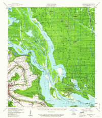
1959 Map of Centerville
USGS Topo · Published 1961About this map
Bayou Teche defines the populated corridor of St. Mary Parish on this 1959 survey, where a string of historic settlements like Franklin, Centerville, and Charenton line the waterway. This area showcases the transition from the concentrated agricultural and residential lands along the Southern Pacific railroad to the expansive wetlands of the Atchafalaya Basin Floodway. The map provides significant detail for genealogists and local historians, noting specific landmarks such as the Evening Star Church, Palo Alto Cem, and Oaklawn Manor.
Find a feature on this map
58 named features on this map. Tap any name to fly to it.
Don’t see what you’re looking for? This feature index may not catch every label — zoom into the map to look around manually.
Map Details
Editions of this 1959 Centerville Map
3 editions found

Other maps of this area

1935 · Morgan City
USGS Topo · 1:62,500

1935 · Chicot Lake
USGS Topo · 1:62,500

1936 · White Castle
USGS Topo · 1:62,500

1937 · Bayou Sale
USGS Topo · 1:62,500

1937 · Jeanerette
USGS Topo · 1:62,500

1941 · Loreauville
USGS Topo · 1:62,500

1941 · Belle Isle
USGS Topo · 1:62,500

1945 · New Orleans
USGS Topo · 1:250,000

1948 · Foster
USGS Topo · 1:62,500

1953 · Napoleonville
USGS Topo · 1:62,500