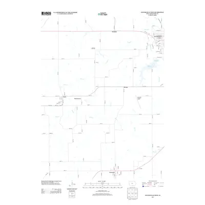
2013 Map of Centerville West
USGS Topo · Published 2013About this map
Centerville and the southern reaches of Appanoose County are detailed in this 2013 survey, showcasing the western residential and industrial infrastructure of the city alongside several rural outposts. The landscape is defined by the winding paths of Cooper Cr and Shoal Cr, which feed into the Upper City Reservoir and Lower City Reservoir. To the west, the gridded streets of Numa and Martinstown mark established rural settlements, while the Appanoose County Farm stands as a notable local landmark north of the Centerville Municipal Airport. In the far south, the town of Cincinnati appears near the border, anchoring a network of county roads including 203rd Ave and 200th Ave. This map provides a contemporary record of long-standing small Iowa communities and the water resources that have shaped their growth over the decades.
Find a feature on this map
93 named features on this map. Tap any name to fly to it.
Don’t see what you’re looking for? This feature index may not catch every label — zoom into the map to look around manually.
Map Details
Editions of this 2013 Centerville West Map
This is the sole edition of this map. No revisions or reprints were ever made.
Other maps of this area

1935 · Russell
USGS Topo · 1:62,500

1938 · Russell
USGS Topo · 1:62,500

1939 · Centerville
USGS Topo · 1:62,500

1939 · Mystic
USGS Topo · 1:62,500

1941 · Centerville
USGS Topo · 1:62,500

1942 · Mystic
USGS Topo · 1:62,500

1942 · Seymour
USGS Topo · 1:62,500

1944 · Seymour
USGS Topo · 1:62,500

1954 · Centerville
USGS Topo · 1:250,000

1957 · Centerville
USGS Topo · 1:250,000