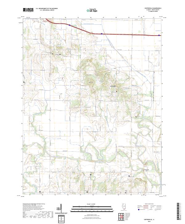
2024 Map of Centerville
USGS Topo · Published 2024About this map
The Little Wabash River and its complex network of drainage ditches and tributaries, such as Wilson Creek and the Schoemann Cutoff, define the landscape of this White County territory. Central to the map is Centerville, a small settlement positioned between the prominent rise of Boyd Hill and the meandering path of the Skillet Fork. The area is notably dense with family and community burial grounds, providing a significant resource for genealogical research with sites like Old Bethel Cem, Mount Pleasant Cem, and Rebstock Cem scattered across the rural sections. These cemeteries, alongside landmarks like Rattlesnake Bluff, highlight the long-standing occupation of the river lowlands. The survey reveals a grid-heavy network of county roads, such as Co RD 2000 N and Co RD 800 E, which navigate around the managed water systems of the Randolph Drainage Ditch and Woods Drainage Ditch.
Find a feature on this map
60 named features on this map. Tap any name to fly to it.
Don’t see what you’re looking for? This feature index may not catch every label — zoom into the map to look around manually.
Map Details
Editions of this 2024 Centerville Map
This is the sole edition of this map. No revisions or reprints were ever made.
Other maps of this area

1940 · Carmi
USGS Topo · 1:62,500

1941 · Enfield
USGS Topo · 1:62,500

1943 · Carmi
USGS Topo · 1:62,500

1943 · Albion
USGS Topo · 1:62,500

1944 · Enfield
USGS Topo · 1:62,500

1946 · Albion
USGS Topo · 1:62,500

1948 · Fairfield
USGS Topo · 1:62,500

1958 · Belleville
USGS Topo · 1:250,000
1959 · Maunie
USGS Topo · 1:24,000

1962 · Belleville
USGS Topo · 1:250,000