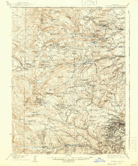
1912 Map of Central City
USGS Topo · Published 1942About this map
Central City and its neighboring gold-mining districts dominate the southeast corner of this high-altitude landscape, where the intense industrial extraction of the early twentieth century is visible in the dense network of gulches and named peaks. The map reveals the vital connection between these remote mountain camps and the outside world through the Denver Northwestern and Pacific railroad, which skirts the Continental Divide at Rollins Pass and passes through the East Portal. To the north, the silver-mining legacy is preserved in settlements like Caribou and Nederland, while the presence of an Aerial Tramway near Central City highlights the specialized engineering required for the era's mineral transport. Beyond the mines, the sheet records a network of high-country lakes such as Yankee Doodle Lake and Loch Lomond, which served as both water sources for mining operations and precursors to the region's eventual transition toward recreation and water management.
Find a feature on this map
168 named features on this map. Tap any name to fly to it.
Don’t see what you’re looking for? This feature index may not catch every label — zoom into the map to look around manually.
Map Details
Editions of this 1912 Central City Map
4 editions found
Other maps of this area

1899 · West Denver
USGS Topo · 1:125,000

1902 · Boulder
USGS Topo · 1:62,500

1903 · Georgetown
USGS Topo · 1:62,500

1904 · Boulder
USGS Topo · 1:62,500

1905 · Central City
USGS Topo · 1:62,500

1905 · Georgetown
USGS Topo · 1:62,500

1906 · Blackhawk
USGS Topo · 1:62,500

1910 · Central City
USGS Topo · 1:62,500

1912 · Central City
USGS Topo · 1:62,500

1915 · Longs Peak
USGS Topo · 1:125,000