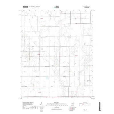
2020 Map of Central
USGS Topo · Published 2020About this map
Central anchors the southern portion of this landscape in Cross County, where the terrain is defined by the winding course of the L'Anguille River and the drainage of First Cr. This 2020 survey illustrates a primarily rural agricultural environment organized by a dense network of secondary roads and local routes, such as Lost Mail Rte and Slocum Rd. The distribution of burial sites across the township, including Slocum Cem, Union Grove Cem, and Hawk Cem, offers essential data points for genealogical research and the study of local family settlement patterns. Named corridors like Union Grove Cemetery Rd and the J B Vannaman road further reflect the localized geography of this Arkansas region. The map provides a clear look at the township and range boundaries that have governed land ownership here for generations.
Find a feature on this map
49 named features on this map. Tap any name to fly to it.
Don’t see what you’re looking for? This feature index may not catch every label — zoom into the map to look around manually.
Map Details
Editions of this 2020 Central Map
This is the sole edition of this map. No revisions or reprints were ever made.
Other maps of this area

1939 · Vanndale
USGS Topo · 1:62,500

1939 · Wynne
USGS Topo · 1:62,500

1939 · Hunter
USGS Topo · 1:62,500

1940 · Tilton
USGS Topo · 1:62,500

1953 · Memphis
USGS Topo · 1:250,000

1956 · Memphis
USGS Topo · 1:250,000

1956 · Tilton
USGS Topo · 1:62,500

1956 · Hunter
USGS Topo · 1:62,500

1958 · Hunter
USGS Topo · 1:62,500

1958 · Wynne
USGS Topo · 1:62,500