
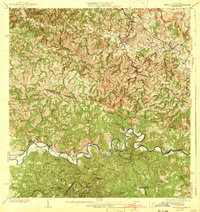
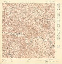
1942 Map of Central La Plata
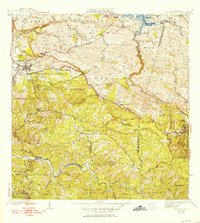
USGS Topo · Published 1942This historical map portrays the area of Central La Plata in 1942, primarily covering San Sebastián Municipio as well as portions of Mayagüez Municipio, Añasco Municipio, and Moca Municipio. Featuring a scale of 1:30000, this map provides a highly detailed snapshot of the terrain, roads, buildings, counties, and historical landmarks in the Central La Plata region at the time. Published in 1942, it is one of 6 known editions of this map due to revisions or reprints.
Find a feature on this map
41 named features on this map. Tap any name to fly to it.
Don’t see what you’re looking for? This feature index may not catch every label — zoom into the map to look around manually.
Map Details
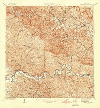
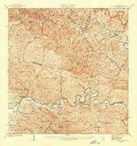
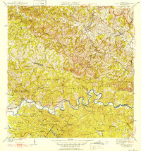
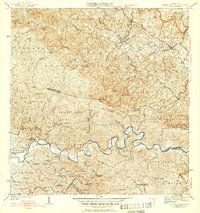
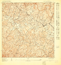
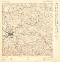
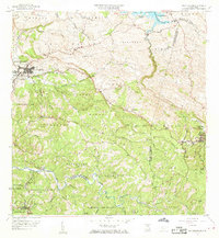
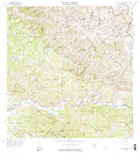
Editions of this 1942 Central La Plata Map
6 editions found
Historical Maps of Sector Los Morales Through Time
13 maps found

1938 Alto Sano
San Sebastián Municipio, PR

1938 San Sebastian
San Sebastián Municipio, PR
1941 San Sebastian
San Sebastián Municipio, PR
1942 Central La Plata
San Sebastián Municipio, PR

1946 Ciales
San Sebastián Municipio, PR
1950 Central La Plata NE
San Sebastián Municipio, PR

1950 San Sebastian NE
San Sebastián Municipio, PR
1950 San Sebastian NO
San Sebastián Municipio, PR
1950 San Sebastian SO
San Sebastián Municipio, PR

1953 Ciales
San Sebastián Municipio, PR

1955 Central La Plata
San Sebastián Municipio, PR
1958 San Sebastian
San Sebastián Municipio, PR
1964 Central La Plata
San Sebastián Municipio, PR
Featured Locations
- Sector Los Ramos, Moca
- Sector Los Crespos, San Sebastián
- Sector Ramos, San Sebastián
- Sector Serrano, San Sebastián
- Sector La Grúa, Añasco