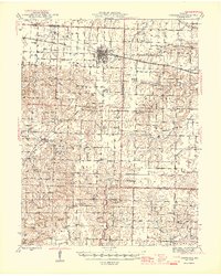
1945 Map of Centralia
USGS Topo · Published 1945About this map
The railroad junction at Centralia serves as the primary hub of this Missouri landscape, where the Wabash and Alton lines intersect. The northern prairie gives way to a more dissected terrain as one moves south toward the Cedar Creek drainage, revealing a densely settled rural society defined by its one-room schools and country churches. A notable industrial feature is the Strip Mine located just west of Centralia, contrasting with the surrounding agricultural townships like Bourbon and Cleveland.
Find a feature on this map
81 named features on this map. Tap any name to fly to it.
Don’t see what you’re looking for? This feature index may not catch every label — zoom into the map to look around manually.
Map Details
Editions of this 1945 Centralia Map
2 editions found

Other maps of this area

1886 · Jefferson City
USGS Topo · 1:125,000

1890 · Mexico
USGS Topo · 1:125,000

1890 · Moberly
USGS Topo · 1:125,000

1890 · Fulton
USGS Topo · 1:125,000

1894 · Jefferson City
USGS Topo · 1:125,000

1917 · Sturgeon
USGS Topo · 1:62,500

1928 · Fulton
USGS Topo · 1:62,500

1931 · Fulton
USGS Topo · 1:62,500

1932 · Mexico
USGS Topo · 1:62,500

1935 · Columbia
USGS Topo · 1:24,000