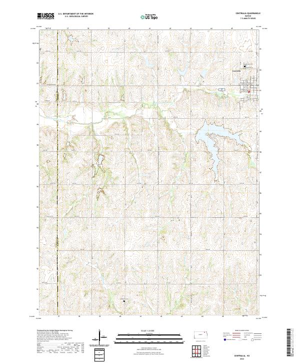
2022 Map of Centralia
USGS Topo · Published 2022About this map
Centralia serves as the primary hub of this prairie landscape, where the town grid is defined by thoroughfares like John Riggins Ave and Railroad Ave. The surrounding countryside is defined by the winding course of the Black Vermillion River and its numerous tributaries, including French Cr and Mulberry Cr. This drainage pattern creates a series of rolling divides across the section lines of the Marshall Co Nemaha Co border. Local heritage is rooted in the small burial grounds that dot the townships, notably Centralia Cem just north of the town limits and the more remote Mulberry Cem to the south. The transition from town streets to the rural section-line road network, including Old Hwy 130, illustrates the enduring structure of the Kansas agricultural economy and its reliance on these waterways and transport corridors.
Find a feature on this map
38 named features on this map. Tap any name to fly to it.
Don’t see what you’re looking for? This feature index may not catch every label — zoom into the map to look around manually.
Map Details
Editions of this 2022 Centralia Map
This is the sole edition of this map. No revisions or reprints were ever made.
Other maps of this area

1889 · Seneca
USGS Topo · 1:125,000

1894 · Seneca
USGS Topo · 1:125,000

1955 · Manhattan
USGS Topo · 1:250,000

1956 · Manhattan
USGS Topo · 1:250,000

1957 · Manhattan
USGS Topo · 1:250,000

1966 · Baileyville
USGS Topo · 1:24,000

1966 · Axtell
USGS Topo · 1:24,000
1966 · Seneca
USGS Topo · 1:24,000
1969 · Centralia
USGS Topo · 1:24,000
1969 · Havensville
USGS Topo · 1:24,000