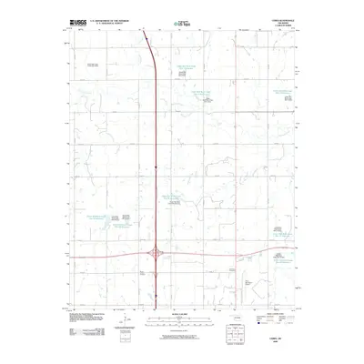
2009 Map of Ceres
USGS Topo · Published 2009About this map
The Oklahoma prairie north of Perry is defined by an extensive network of water management projects and rural burial grounds in this 2009 survey. The landscape is dominated by a sequence of reservoirs and dams along the Upper and Lower Red Rock Creek systems, including the Upper Red Rock Creek Site 56 Reservoir and Lower Red Rock Creek Site 13 Reservoir. These engineered water bodies reflect the region's mid-century shift toward flood control and agricultural stabilization. Genealogists will find the locations of Mount Carmel Cemetery and Bohemian Cemetery helpful for tracing local family roots. Transportation infrastructure is anchored by the Enid Interchange and the Perry Municipal Airport, while a strict grid of section roads like e0380 RD facilitates movement across the drainage basins of Hackberry Creek and Doe Creek.
Find a feature on this map
34 named features on this map. Tap any name to fly to it.
Don’t see what you’re looking for? This feature index may not catch every label — zoom into the map to look around manually.
Map Details
Editions of this 2009 Ceres Map
This is the sole edition of this map. No revisions or reprints were ever made.
Other maps of this area

1955 · Enid
USGS Topo · 1:250,000

1958 · Enid
USGS Topo · 1:250,000

1968 · Billings
USGS Topo · 1:24,000

1968 · Tonkawa SE
USGS Topo · 1:24,000

1968 · Marland
USGS Topo · 1:24,000

1972 · Perry NW
USGS Topo · 1:24,000

1972 · Red Rock
USGS Topo · 1:24,000

1972 · Ceres
USGS Topo · 1:24,000

1972 · Perry
USGS Topo · 1:24,000

1972 · Lucien
USGS Topo · 1:24,000