
1972 Map of Lucien
USGS Topo · Published 1974About this map
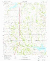
Lucien and the surrounding plains of the Garfield and Noble County border were defined by energy and transportation in the early 1970s. The landscape is densely populated with an extensive Oil Field network, marked by numerous Oil Wells, a Gas Well, and a Landing Strip. The St Louis - San Francisco railroad cuts across the southern portion of the quadrangle, serving the small community of Gansel and the local Filtration Plant.
Find a feature on this map
21 named features on this map. Tap any name to fly to it.
Don’t see what you’re looking for? This feature index may not catch every label — zoom into the map to look around manually.
Map Details
Editions of this 1972 Lucien Map
This is the sole edition of this map. No revisions or reprints were ever made.
Other maps of this area

1893 · Mulhall
USGS Topo · 1:62,500

1893 · Lovell
USGS Topo · 1:62,500

1955 · Enid
USGS Topo · 1:250,000

1956 · Garber
USGS Topo · 1:62,500

1958 · Enid
USGS Topo · 1:250,000

1972 · Perry NW
USGS Topo · 1:24,000

1972 · Ceres
USGS Topo · 1:24,000

1972 · Perry
USGS Topo · 1:24,000
1974 · Orlando East
USGS Topo · 1:24,000

1974 · Marshall East
USGS Topo · 1:24,000