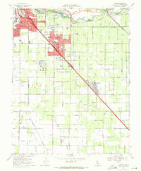
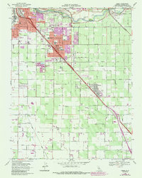
1969 Map of Ceres
USGS Topo · Published 1971About this map
The Tuolumne River carves the northern edge of this agricultural landscape, where the growing city of Modesto meets the expanding orchard and pasture lands of central Stanislaus County. The corridor of the Southern Pacific railroad serves as the primary axis for development, anchoring the communities of Ceres and Keyes. This 1969 survey reveals a transitional period where rural schoolhouses like White Sch and Don Pedro Sch sit alongside emerging civic landmarks, including the Modesto City-County Airport and County Memorial Hospital.
Find a feature on this map
65 named features on this map. Tap any name to fly to it.
Don’t see what you’re looking for? This feature index may not catch every label — zoom into the map to look around manually.
Map Details
Editions of this 1969 Ceres Map
5 editions found
Other maps of this area

1915 · Westport
USGS Topo · 1:31,680

1915 · Salida
USGS Topo · 1:31,680

1916 · Mitchell School
USGS Topo · 1:31,680

1916 · Crows Landing
USGS Topo · 1:31,680

1916 · Riverbank
USGS Topo · 1:31,680

1916 · Denair
USGS Topo · 1:31,680

1916 · Waterford
USGS Topo · 1:31,680

1916 · Ceres
USGS Topo · 1:31,680

1917 · Turlock
USGS Topo · 1:31,680

1919 · Orestimba
USGS Topo · 1:62,500