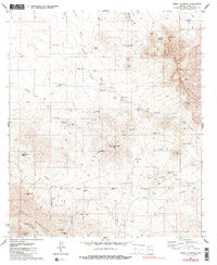
1979 Map of Cerro Colorado
USGS Topo · Published 1985About this map
The Cerro Colorado Mountains and the Las Guijas Mountains dominate this high-desert Arizona landscape, revealing a territory defined by hard-rock mining and cattle ranching. Numerous mining operations dot the terrain, from the Liberty Mine and New Colorado Mine near the center of the quadrangle to the Arivaca King Mine in the southwest. These workings, alongside various prospect points like the Black Princess Mine, indicate a significant history of mineral exploration in Pima County.
Find a feature on this map
52 named features on this map. Tap any name to fly to it.
Don’t see what you’re looking for? This feature index may not catch every label — zoom into the map to look around manually.
Map Details
Editions of this 1979 Cerro Colorado Map
3 editions found
Other maps of this area

1920 · Arivaca
USGS Topo · 1:125,000

1925 · Samaniego Peak
USGS Topo · 1:62,500

1939 · Twin Buttes
USGS Topo · 1:62,500

1939 · Tubac
USGS Topo · 1:62,500

1940 · Palo Alto Ranch
USGS Topo · 1:62,500

1941 · Twin Buttes
USGS Topo · 1:62,500

1941 · Arivaca
USGS Topo · 1:62,500

1943 · Arivaca
USGS Topo · 1:62,500

1943 · Palo Alto Ranch
USGS Topo · 1:62,500

1943 · Tubac
USGS Topo · 1:62,500