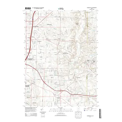
2013 Map of Chagrin Falls
USGS Topo · Published 2013About this map
Chagrin Falls and the surrounding eastern suburbs of the Cleveland area appear in high detail in this 2013 survey, which highlights the dense network of residential development, local cemeteries, and remaining industrial sites. The map documents the intricate hydrology of the region, where the Chagrin River and its various tributaries like Willey Cr and Griswold Cr cut through the terrain. Notable for genealogists and local historians, numerous family-named landmarks and burial grounds are preserved, including the Jackson Family Plot and the Warrensville Cem. The eastern portion of the sheet shows the concentrated commercial and manufacturing center at Chagrin Falls, featuring the Chase Bag Company and the local Po. Aviation history is represented by the Harper Ridge Airport located south of Orange, while the surrounding landscape transitions between the established settlements of Solon and Hunting Valley.
Find a feature on this map
231 named features on this map. Tap any name to fly to it.
Don’t see what you’re looking for? This feature index may not catch every label — zoom into the map to look around manually.
Map Details
Editions of this 2013 Chagrin Falls Map
This is the sole edition of this map. No revisions or reprints were ever made.
Other maps of this area

1901 · Euclid
USGS Topo · 1:62,500

1903 · Cleveland
USGS Topo · 1:62,500

1903 · Euclid
USGS Topo · 1:62,500

1905 · Mentor
USGS Topo · 1:62,500

1906 · Chagrin Falls
USGS Topo · 1:62,500

1907 · Mentor
USGS Topo · 1:62,500

1908 · Chagrin Falls
USGS Topo · 1:62,500

1950 · Cleveland
USGS Topo · 1:250,000

1953 · South Russell
USGS Topo · 1:24,000

1953 · Aurora
USGS Topo · 1:24,000