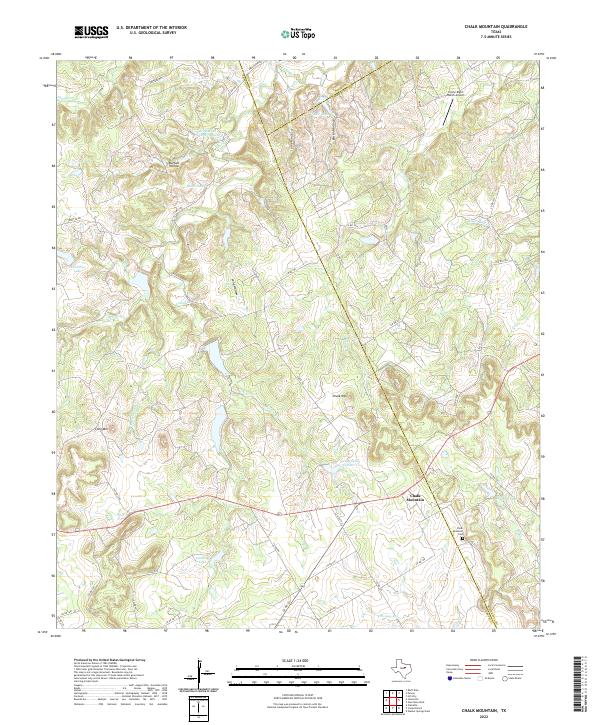
2022 Map of Chalk Mountain
USGS Topo · Published 2022About this map
Chalk Mountain and its surrounding ranchlands sit at the convergence of Erath, Hood, and Somervell counties, defined by a landscape of prominent elevations and creek drainage. The settlement is anchored by the Chalk Mountain Cem, a key site for local genealogical research, while the terrain is marked by distinctive rises like Lone Mtn and Chalk Mtn. This upland environment is deeply carved by water, with Pony Cr and the E Bosque River flowing through a series of hollows including Buffalo Hollow and Big Kid Hollow.
Find a feature on this map
56 named features on this map. Tap any name to fly to it.
Don’t see what you’re looking for? This feature index may not catch every label — zoom into the map to look around manually.
Map Details
Editions of this 2022 Chalk Mountain Map
This is the sole edition of this map. No revisions or reprints were ever made.
Other maps of this area

1889 · Granbury
USGS Topo · 1:125,000

1890 · Stephenville
USGS Topo · 1:125,000

1920 · Stephenville
USGS Topo · 1:125,000

1931 · Tolar
USGS Topo · 1:62,500

1954 · Dallas
USGS Topo · 1:250,000

1954 · Abilene
USGS Topo · 1:250,000

1958 · Dallas
USGS Topo · 1:250,000

1958 · Abilene
USGS Topo · 1:250,000

1961 · Johnsville
USGS Topo · 1:24,000
1961 · Hill City
USGS Topo · 1:24,000