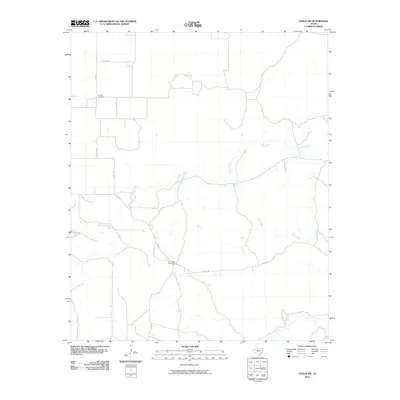
2010 Map of Chalk SW
USGS Topo · Published 2010About this map
JY Ranch West Camp and the winding course of Farrer Creek characterize this portion of King County, where the landscape is defined by traditional ranching lands and isolated homesteads. The terrain is crisscrossed by a network of county roads, such as Co Rd 204 and Co Rd 451, which connect the disparate outposts of this West Texas region. A significant historical anchor for the area is the Shinnery Cemetery, situated in the northwest. The sparse distribution of named points, including Dry Creek, reflects the enduring rural character of this environment, where the proximity to established ranch camps remains a primary focal point for local identity and land use.
Find a feature on this map
11 named features on this map. Tap any name to fly to it.
Don’t see what you’re looking for? This feature index may not catch every label — zoom into the map to look around manually.
Map Details
Editions of this 2010 Chalk SW Map
This is the sole edition of this map. No revisions or reprints were ever made.
Other maps of this area

1954 · Lubbock
USGS Topo · 1:250,000

1966 · Ox Yoke Creek
USGS Topo · 1:24,000

1966 · Chalk SW
USGS Topo · 1:24,000

1966 · J Y Ranch
USGS Topo · 1:24,000

1966 · Lowrance Mountain
USGS Topo · 1:24,000

1967 · Fourmile Hill
USGS Topo · 1:24,000

1968 · Y Ranch
USGS Topo · 1:24,000

1968 · Grow
USGS Topo · 1:24,000
1968 · Chalk
USGS Topo · 1:24,000
1968 · Ginsite
USGS Topo · 1:24,000