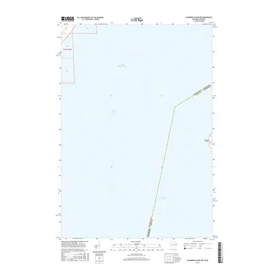
2016 Map of Chambers Island NW
USGS Topo · Published 2016About this map
Green Bay and the cold expanse of Lake Michigan meet along a critical state boundary in this maritime survey. The map centers on the open water of the Great Lakes, defined by the invisible line separating Michigan and Wisconsin. To the east, the western edge of Chambers Island emerges as the only significant landmass, marking a strategic point for navigation and local history within the bay. This 2016 edition provides a precise look at the bathymetry and jurisdictional borders during the early 21st century. The map is largely a study of these aqueous boundaries, showing how the mid-lake border of Menominee County and Door County bisects the shipping routes between the Upper Peninsula and the Door Peninsula.
Find a feature on this map
12 named features on this map. Tap any name to fly to it.
Don’t see what you’re looking for? This feature index may not catch every label — zoom into the map to look around manually.
Map Details
Editions of this 2016 Chambers Island NW Map
This is the sole edition of this map. No revisions or reprints were ever made.
Other maps of this area

1939 · Marinette
USGS Topo · 1:48,000

1949 · Stephenson
USGS Topo · 1:48,000

1954 · Escanaba
USGS Topo · 1:250,000

1957 · Escanaba
USGS Topo · 1:250,000

1958 · Escanaba
USGS Topo · 1:250,000

1961 · Chambers Island
USGS Topo · 1:62,500

1963 · Cedar River
USGS Topo · 1:62,500
1963 · Birch Creek
USGS Topo · 1:24,000
1963 · Marinette East
USGS Topo · 1:24,000

1963 · Stephenson
USGS Topo · 1:62,500