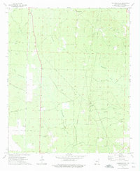
1973 Map of Chambersville
USGS Topo · Published 1975About this map
Chambersville sits at the northern edge of this Calhoun County landscape, where the terrain is defined by a dense network of timber-country tributaries and local landmarks. The map traces the winding paths of Champagnolle Creek and Whitewater Creek through a region marked by rural community centers like Bluff Hill Ch and Sulphur Springs Ch. Of particular interest to industrial historians is the T & A Tram, a relic of the area's logistical past, and the Bud Hill Lookout Tower standing over the woodlands.
Find a feature on this map
37 named features on this map. Tap any name to fly to it.
Don’t see what you’re looking for? This feature index may not catch every label — zoom into the map to look around manually.
Map Details
Editions of this 1973 Chambersville Map
2 editions found
Other maps of this area

1903 · Camden
USGS Topo · 1:125,000

1953 · El Dorado
USGS Topo · 1:250,000

1957 · El Dorado
USGS Topo · 1:250,000

1958 · El Dorado
USGS Topo · 1:250,000

1960 · El Dorado
USGS Topo · 1:250,000

1966 · Kingsland
USGS Topo · 1:24,000

1966 · Fordyce
USGS Topo · 1:24,000

1973 · Bearden
USGS Topo · 1:24,000
1973 · Hampton
USGS Topo · 1:24,000
1973 · Woodberry
USGS Topo · 1:24,000