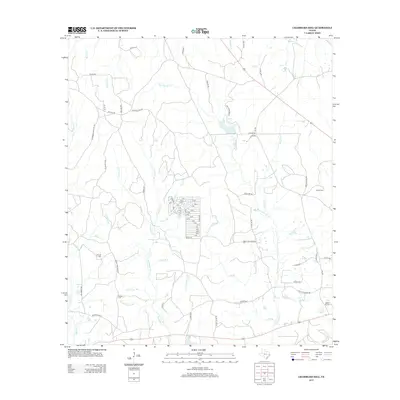
2013 Map of Chambliss Hill
USGS Topo · Published 2013About this map
Big Cypress Creek and its many tributaries, including Coontop Creek and Horsepen Creek, dominate this section of Polk County. The landscape is marked by a dense network of country roads named for local families and historic activities, such as Old CCC Rd and Jim Hubert Rd. Genealogists will find several burial sites preserved on this 2013 survey, including George Cemetery and Hubert Cemetery, often situated near the creeks that defined early landholdings. To the southeast, Camp Niwana and Camp Niwa Spring indicate the area's transition toward recreational use. Small residential clusters are visible along Neely Rd, while the presence of Pipeline Rd and Pure Oil Rd points to the continued significance of the energy industry in the East Texas piney woods.
Find a feature on this map
87 named features on this map. Tap any name to fly to it.
Don’t see what you’re looking for? This feature index may not catch every label — zoom into the map to look around manually.
Map Details
Editions of this 2013 Chambliss Hill Map
This is the sole edition of this map. No revisions or reprints were ever made.
Other maps of this area

1954 · Beaumont
USGS Topo · 1:250,000

1955 · Woodville
USGS Topo · 1:62,500

1955 · Camden
USGS Topo · 1:62,500

1957 · Beaumont
USGS Topo · 1:250,000

1958 · Segno
USGS Topo · 1:62,500

1958 · Warren
USGS Topo · 1:62,500

1984 · Hortense
USGS Topo · 1:24,000
1984 · Chester
USGS Topo · 1:24,000

1984 · Beaumont
USGS Topo · 1:250,000

1984 · Jacks Creek North
USGS Topo · 1:24,000