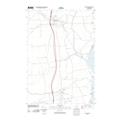
2010 Map of Champlain
USGS Topo · Published 2010About this map
Champlain and Chazy anchor this northern New York landscape near the Canadian border, where the industrial and agricultural heritage of Clinton County is etched into the terrain. The Great Chazy River snakes through the village of Champlain, passing near the Glenwood Cemetery and Saint Marys Cemetery, while the Little Chazy River defines the southern portion of the quadrangle. Along the western shore of Lake Champlain, the map details the maritime transition from the Chazy Boat Basin to the historic Chazy Landing, a critical point of lake access. Inland, the presence of the Chazy Orchard suggests the enduring importance of fruit production in this region. This survey captures a moment of modern connectivity where Interstate 87 bisects a land still governed by its natural waterways and family-named roads like Perry Mills Rd and Miner Farm Rd.
Find a feature on this map
47 named features on this map. Tap any name to fly to it.
Don’t see what you’re looking for? This feature index may not catch every label — zoom into the map to look around manually.
Map Details
Editions of this 2010 Champlain Map
This is the sole edition of this map. No revisions or reprints were ever made.
Other maps of this area

1895 · Mooers
USGS Topo · 1:62,500

1895 · Rouse Point
USGS Topo · 1:62,500

1899 · Mooers
USGS Topo · 1:62,500

1907 · Rouse Point
USGS Topo · 1:62,500

1939 · Rouses Point
USGS Topo · 1:62,500

1942 · Mooers
USGS Topo · 1:62,500

1943 · Mooers
USGS Topo · 1:62,500

1943 · Rouses Point
USGS Topo · 1:62,500

1950 · Lake Champlain
USGS Topo · 1:250,000

1956 · Rouses Point
USGS Topo · 1:62,500