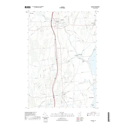
2019 Map of Champlain
USGS Topo · Published 2019About this map
Lake Champlain dominates the eastern boundary of this Clinton County landscape, where the Great Chazy River and Little Chazy River empty into the lake's northern reaches. The settlement of Champlain sits as a central hub, connected by the Great Chazy River Bridge and surrounded by a network of rural cemeteries including Glenwood Cem and Saint Marys Cem. Near the northern border, the small community of Perry Mills and the lakeside village of Rouses Point mark the area's transition toward the international boundary. Moving south along the shoreline, Chazy Landing and the Chazy Boat Basin at King Bay reflect a long-standing orientation toward maritime activity. This era shows a landscape where industrial corridors like the Lawrence Paquette Industrial Dr coexist with traditional agrarian holdings and family-named routes such as Dumont Rd and Miner Farm Rd.
Find a feature on this map
72 named features on this map. Tap any name to fly to it.
Don’t see what you’re looking for? This feature index may not catch every label — zoom into the map to look around manually.
Map Details
Editions of this 2019 Champlain Map
This is the sole edition of this map. No revisions or reprints were ever made.
Other maps of this area

1895 · Mooers
USGS Topo · 1:62,500

1895 · Rouse Point
USGS Topo · 1:62,500

1899 · Mooers
USGS Topo · 1:62,500

1907 · Rouse Point
USGS Topo · 1:62,500

1939 · Rouses Point
USGS Topo · 1:62,500

1942 · Mooers
USGS Topo · 1:62,500

1943 · Mooers
USGS Topo · 1:62,500

1943 · Rouses Point
USGS Topo · 1:62,500

1950 · Lake Champlain
USGS Topo · 1:250,000

1956 · Rouses Point
USGS Topo · 1:62,500