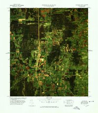
1977 Map of Champlain Port of Entry
USGS Topo · Published 1978About this map
The Canada United States international border bisects this color image map, showcasing the critical infrastructure of the late 1970s North Country. The Champlain Port of Entry U S Customs serves as a central hub, where the interstate highway system meets the landscape of northern New York and southern Quebec. To the south, the settlement of Chazy sits near the winding banks of the Great Champlain River, while the northern portion of the map covers Canadian territory including Lacolle and Odelltown. A network of rural roads like Meridian Road and Glass Road crisscross the agricultural patchwork, providing access to smaller communities such as Perry Mills. The imagery provides a clear view of the Railroad Grade and topographical landmarks like Prospect Hill, documenting the gateway between two nations before modern facility expansions.
Find a feature on this map
33 named features on this map. Tap any name to fly to it.
Don’t see what you’re looking for? This feature index may not catch every label — zoom into the map to look around manually.
Map Details
Editions of this 1977 Champlain Port of Entry Map
This is the sole edition of this map. No revisions or reprints were ever made.
Other maps of this area

1895 · Mooers
USGS Topo · 1:62,500

1895 · Rouse Point
USGS Topo · 1:62,500

1899 · Mooers
USGS Topo · 1:62,500

1907 · Rouse Point
USGS Topo · 1:62,500

1939 · Rouses Point
USGS Topo · 1:62,500

1942 · Mooers
USGS Topo · 1:62,500

1943 · Mooers
USGS Topo · 1:62,500

1943 · Rouses Point
USGS Topo · 1:62,500

1950 · Lake Champlain
USGS Topo · 1:250,000

1956 · Rouses Point
USGS Topo · 1:62,500