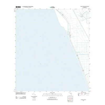
2012 Map of Chancy Bay
USGS Topo · Published 2012About this map
Lake Okeechobee dominates the western half of this Florida survey, where the vast freshwater surface meets the intricate canal and dike infrastructure of the eastern shore. The map centers on the cove of Chancy Bay, a distinct indentation along the lake's edge defined by its proximity to the primary transit corridors. Parallel highways 98 441 and 15 700 run southeast along the coastline, anchoring the narrow strip of development between the water and the inland agricultural grid. Significant local landmarks include the Brady Ranch Airport, located just inland from the northeastern shoreline. The landscape reveals a highly engineered environment where drainage canals and straight-line roads intersect, illustrating the mid-century management of the Florida Everglades' northern reaches for transport and land use.
Find a feature on this map
5 named features on this map. Tap any name to fly to it.
Don’t see what you’re looking for? This feature index may not catch every label — zoom into the map to look around manually.
Map Details
Editions of this 2012 Chancy Bay Map
This is the sole edition of this map. No revisions or reprints were ever made.
Other maps of this area

1952 · Okeechobee
USGS Topo · 1:24,000

1953 · Okeechobee 4 SW
USGS Topo · 1:24,000

1953 · Okeechobee 4 SE
USGS Topo · 1:24,000

1953 · Okeechobee 4 NE
USGS Topo · 1:24,000

1953 · Okeechobee 4 NW
USGS Topo · 1:24,000

1956 · West Palm Beach
USGS Topo · 1:250,000

1956 · Fort Pierce
USGS Topo · 1:250,000

1957 · West Palm Beach
USGS Topo · 1:250,000

1958 · Fort Pierce
USGS Topo · 1:250,000

1958 · West Palm Beach
USGS Topo · 1:250,000