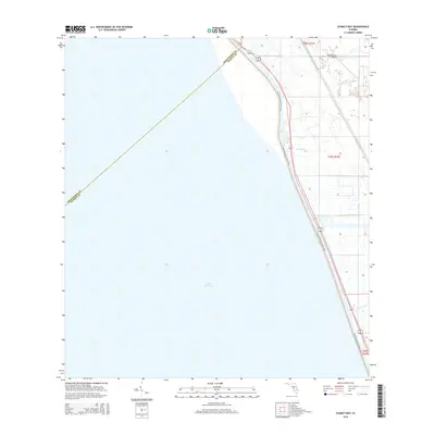
2015 Map of Chancy Bay
USGS Topo · Published 2015About this map
Lake Okeechobee dominates the western half of this Florida survey, meeting the eastern shore at Chancy Bay. This coastal margin represents a thin but vital corridor of transit and infrastructure, where the Florida National Scenic Trail winds alongside the historic Florida East Coast railroad line. The landscape is defined by the sharp boundary between the open water and the low-lying interior wetlands of Martin County, characterized by drainage systems and township divisions including t39s r37e. A notable local landmark is the Brady Ranch Airport, situated just inland from the northern bay. The map illustrates the engineering required to manage the shoreline, where highways and rail lines parallel the lake's perimeter to maintain connectivity through this marshy transition zone.
Find a feature on this map
9 named features on this map. Tap any name to fly to it.
Don’t see what you’re looking for? This feature index may not catch every label — zoom into the map to look around manually.
Map Details
Editions of this 2015 Chancy Bay Map
This is the sole edition of this map. No revisions or reprints were ever made.
Other maps of this area

1952 · Okeechobee
USGS Topo · 1:24,000

1953 · Okeechobee 4 SW
USGS Topo · 1:24,000

1953 · Okeechobee 4 SE
USGS Topo · 1:24,000

1953 · Okeechobee 4 NE
USGS Topo · 1:24,000

1953 · Okeechobee 4 NW
USGS Topo · 1:24,000

1956 · West Palm Beach
USGS Topo · 1:250,000

1956 · Fort Pierce
USGS Topo · 1:250,000

1957 · West Palm Beach
USGS Topo · 1:250,000

1958 · Fort Pierce
USGS Topo · 1:250,000

1958 · West Palm Beach
USGS Topo · 1:250,000