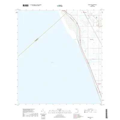
2018 Map of Chancy Bay
USGS Topo · Published 2018About this map
Lake Okeechobee dominates the western half of this Florida landscape, meeting the land at a shore defined by the Florida National Scenic Trail. This 2018 survey captures the interface of Martin and Okeechobee counties along the lake's eastern edge, where the Florida East Coast rail line parallels the water. Settlement is concentrated in the east, characterized by the grid of the Public Land Survey System and the development near Chukker Cir. Aviation and recreation are central to the area's current character, evidenced by the Brady Ranch Airport and the coastal indentation of Chancy Bay. The map provides a clear record of modern drainage and property boundaries in this wetland-adjacent region just before the close of the decade.
Find a feature on this map
11 named features on this map. Tap any name to fly to it.
Don’t see what you’re looking for? This feature index may not catch every label — zoom into the map to look around manually.
Map Details
Editions of this 2018 Chancy Bay Map
This is the sole edition of this map. No revisions or reprints were ever made.
Other maps of this area

1952 · Okeechobee
USGS Topo · 1:24,000

1953 · Okeechobee 4 SW
USGS Topo · 1:24,000

1953 · Okeechobee 4 SE
USGS Topo · 1:24,000

1953 · Okeechobee 4 NE
USGS Topo · 1:24,000

1953 · Okeechobee 4 NW
USGS Topo · 1:24,000

1956 · West Palm Beach
USGS Topo · 1:250,000

1956 · Fort Pierce
USGS Topo · 1:250,000

1957 · West Palm Beach
USGS Topo · 1:250,000

1958 · Fort Pierce
USGS Topo · 1:250,000

1958 · West Palm Beach
USGS Topo · 1:250,000